 |
HURRICANE GUSTAV
|
 |
|
|
HURRICANE GUSTAV
|
|
|
|
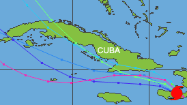
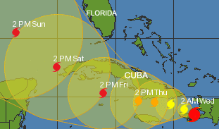
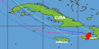
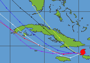
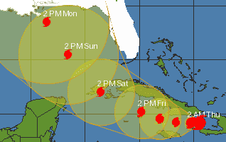
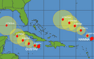
8-26-2008 Hurricane Gustav - Maximum sustained winds 75mph with higher gusts. Moving NW at 10mph National Weather Forecasters Long range prediction Gustav predicted path would take it over Cuba on Saturday Predicted 5 Day Track of Hurricane Gustav Gustav predicted not to track over Florida |
|
|
|
|
|
Back to
Main Page Florida Hurricane Info For 2008 - NOAA Predicts a Near Normal or Above Normal Atlantic Hurricane Season. The outlook indicates a 65% chance of 12 to 16 named storms, including 6 to 9 hurricanes and 2 to 5 major hurricanes. An average season has 11 named storms, including 6 hurricanes for which 2 reach major status. This outlook is a general guide and does not predict where or when any storms may hit land. That's the job of the National Hurricane Center after a storm forms. 2008 Named Tropical Storms and Hurricanes Arthur, Bertha, Cristobal, Dolly, Genevieve, Edouard, Fay, Gustav, Iselle Tips after a Hurricane Do not examine your home for damage with matches, candles, or other other "flame based" lighting. Use flashlights. Avoid downed power lines. If you stored water in open containers such s bathtubs, do not drink without purifying first. Items that you should always have available or can purchase- Non-electric can opener, flashlights, radios, portable TV's, cans of sterno, candles, dry food, canned food, bottled water. Chart From 1950 to 2004 in the United States Major Hurricane Land Strikes Current Florida Keys - South Florida and Cuba - Radar Weather Map Tropical Storms Tracking Path Images Tropical Storm Fay
The Atlantic hurricane
season officially is from June 1st through November 30th. |
CHARTS MAPS TROPICAL STORMS SATELLITE
IMAGES NATIONAL WEATHER SERVICE SAFETY
PRECAUTIONS TIPS. COUNTIES EMERGENCY MANAGEMENT SHELTERS EVACUATION PLANS
FLOOD ZONES INSURANCE TAMPA BAY REAL ESTATE HOMES REPAIRS STORM DAMAGE
HURRICANE GUSTAV IMAGES PATH